
Walk a Fort Smith Street
A Fort Smith street directory can establish public ownership and show dated signs of occupancy, but no source supplies a complete household list. Begin with the land. The Sebastian County Assessor ties an address to a parcel, owner, mailing destination, and legal description. The GIS map then places that parcel beside the next one. Recorded deeds establish transfer history. Voter data and printed directories have narrower legal or historical uses.
- Enter the address in the Sebastian County real-estate search. Copy the situs, owner, parcel number, and legal description into separate fields.
- Open the county GIS map. Follow actual parcel boundaries along the named street instead of guessing an address-number range.
- Use the legal description and owner name to identify the acquisition deed through the County Clerk, then verify the recording district.
- Check CityView for address-linked permits, inspections, planning activity, or code records. Treat every applicant or contractor as a stated role, not an occupant.
- For an older snapshot, use the library's street or criss-cross section and bridge changed street names with period maps.
VoterView can confirm a person's own registration through identity fields. A formal voter-data request has use limits and can omit secure voters, so neither method completes a street-by-street roster.
Fort Smith Address Roles
Three address fields prevent the most common street directory error. The situs address is the land's physical location. The owner mailing address is where tax notices go. The legal description identifies the land through subdivision, lot, block, or metes-and-bounds wording. A remote mailing address may suggest absentee ownership, but it says nothing certain about the people at the situs.
- Parcel
- A mapped assessment unit with its own county identifier.
- Situs address
- The physical location assigned to the parcel.
- Plat
- A recorded map that defines lots, blocks, streets, or subdivisions.
- Criss-cross directory
- A publication arranged by street and number, allowing an address-to-name search.
Homestead credit supports a claim that an owner treated the parcel as a principal residence. It does not name relatives, guests, or any other occupant. Use the Fort Smith street directory to label these roles, not to collapse them.
Corner parcels and vacant land can carry a situs number that does not fit the apparent run. Parcel splits and combinations can also cause the Assessor to issue a new parcel number. When the number changes, the legal description and ownership history become the safer bridge to the prior record.
Sebastian GIS Street Search
The Sebastian County Assessor resources link to real-estate records, deed access, and county mapping. The live GIS begins with a disclaimer. Public users must accept it before opening the map; account login is a separate route.
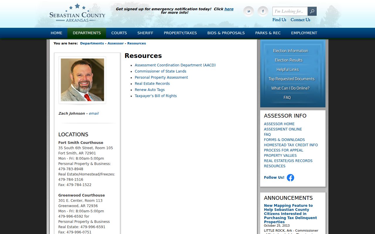
The resource screen provides the correct county path into parcel research without implying that the map itself is a legal survey.
| GIS control | Type | Requirement | Use |
|---|---|---|---|
| I have read and agree | Checkbox | Required for public map | Accept mapping disclaimer |
| Go to Map | Button | After acceptance | Open public parcel viewer |
| Username or Email | Text | Account access only | Separate registered route |
| Password | Password | Account access only | Registered sign-in |
County descriptions confirm layers for school districts, floodplain, zoning, and Pictometry. Exact browse, select, measure, and adjacent-parcel control labels were not verified. Click visible parcels one at a time instead of inventing a radius tool or relying on an export the portal may not permit.
The county disclaimer says mapping is reference-only, may not update at once, and is not guaranteed accurate. Recorded plats and deeds control legal acreage and ownership. The map is not for emergency dispatch. That makes GIS ideal for seeing the parcel sequence, but not for settling a boundary dispute.
Note: Save the parcel number and legal description before leaving the map because street labels alone may not survive a later name change.
Fort Smith Street Record Coverage
Address-keyed sources overlap without duplicating one another. The parcel and legal description make the most stable bridge. A street name can change, and a mailing address can point elsewhere, but the recorded land description allows the deed chain to stay on the same property.
| Address record | Local keeper | Street evidence | Channel |
|---|---|---|---|
| Assessment card | County Assessor | Owner, situs, mail, parcel, value, homestead | Online records or Room 105 |
| GIS map | County Assessor | Parcel sequence, districts, floodplain, zoning | Public viewer after disclaimer |
| Deed or lien | County Clerk/Recorder | Parties, instrument, legal land identity | Credential route, counter, or written request |
| Permit or inspection | Fort Smith Building Services | Work, applicant, contractor, status | CityView or FOIA request |
| Tax payment | Treasurer/Collector | Tax status, payment, delinquency | County tax service |
| Historical directory | Fort Smith Public Library | Dated occupant or business snapshot | Hardcopy, microfilm, staff help |
The Sebastian County property and tax hub separates assessment, tax collection, and Clerk work.

That routing keeps an ownership question with the Assessor and a payment-status question with the Collector.
From Fort Smith Parcel to Deed
After identifying the parcel, move to the Sebastian County recorded deed page. The public-facing language is aimed at title and abstract companies and says uncredentialed companies should contact the Clerk for access. The underlying record can still be requested at the Room 102 counter or in writing. Call 479-782-5065 when the correct route is unclear.
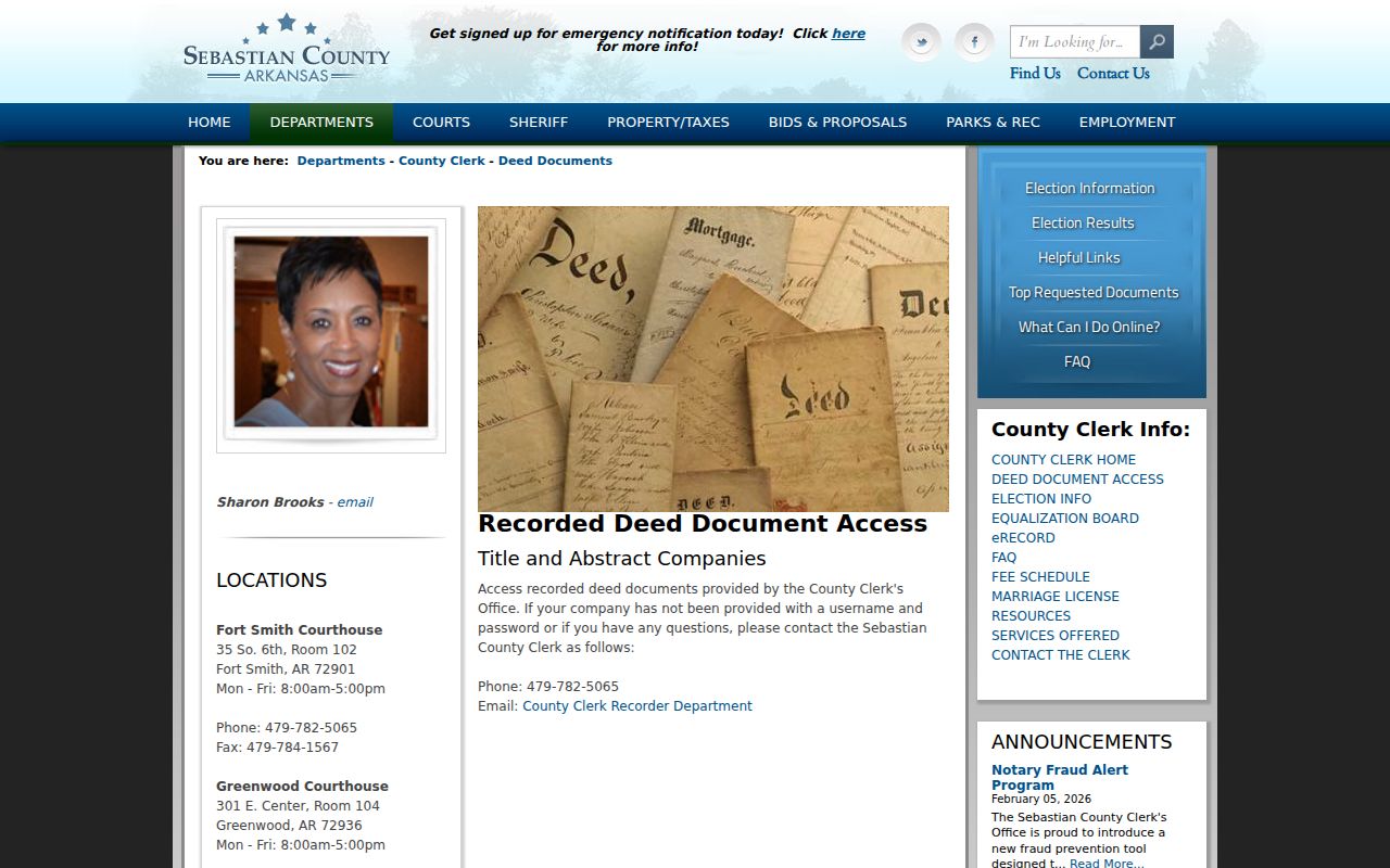
The credential notice is a portal limit, not a finding that public deeds are unavailable.
A strong request supplies grantor or grantee names, approximate recording date, Fort Smith or Greenwood District, and the parcel's legal description. The exact public search fields and online start year were not exposed. At the counter, inspect the index or deed book and ask about uncertified versus certified copies. Grantor means the person transferring an interest; grantee means the person receiving it.
Note: The recorded deed, not the GIS outline, controls when the street search turns on ownership terms or legal acreage.
Fort Smith Recording Costs
The County Clerk's published fee schedule gives the street directory workflow a practical endpoint. Recording charges for deeds, mortgages, powers of attorney, certain liens, plats, and surveys generally start at $15 for the first page plus $5 for each added page. A plat or survey copy is listed at $1. Ordinary copies are 50 cents in person or $1 by mail. Verify current prices before ordering.
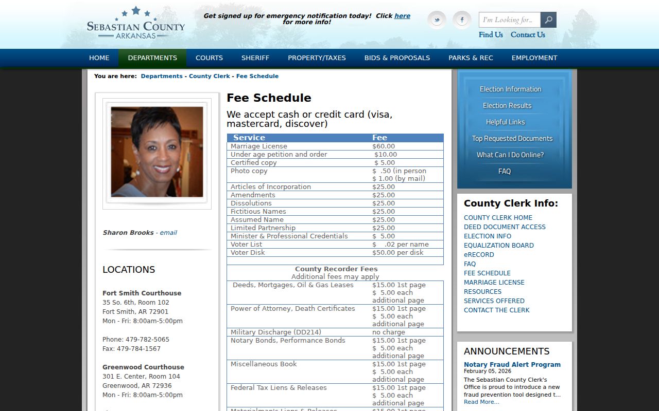
The fee page helps distinguish the cost to record a new document from the cost to copy an existing one.
Inspection at the county office can save a poor copy request. Identify the instrument first, then order only the pages and certification actually needed. A parcel card or map does not replace the recorded deed when legal acreage or ownership terms matter.
Mail requests can cost more per ordinary photocopy than counter copies. Ask the Clerk to confirm the current total before sending payment. The street directory task usually needs an existing instrument copy, not the fee charged to record a new deed.
Fort Smith CityView by Address
Fort Smith CityView accepts a Property Address field. Begin typing a street address or parcel number, then select the matching location from autocomplete. JavaScript is required. A map and legend appear below, but the downstream property, permit, and code-case labels were not verified without selecting a live parcel.
City records requested through FOIA can include permits, plans, inspection reports, certificates of occupancy, code violations, and stop-work orders. These categories appear in city request logs, but they are not promised as one complete online database. If CityView stops, use the city portal or FOIA@fortsmithar.gov. Name the address, date range, department, record type, and preferred electronic format. Stored records can require up to three working days under Arkansas FOIA.
Inspection of an existing public record is free under the state act. Copy charges reflect actual reproduction plus mailing or transmission, and the custodian can require advance payment when an estimate exceeds $25. A permit file can document work at a parcel. It cannot prove that the applicant lived there.
Note: Ask CityView for the parcel first, then frame any Fort Smith records request around one address, record type, and date range.
Fort Smith Streets Before 1897
Fort Smith's modern numbered and lettered grid can break an old address search. Ordinances from 1891 through 1897 replaced many names. North G became Vine, North H became Oak, North I became Maple, and the sequence continued through named streets such as Chestnut, Poplar, Cherry, Plum, Grape, Pear, Mary, William, and Meade. Park Avenue was once Kent. Rogers Avenue was once Little Rock.
Search a period directory with the name used that year. Then compare its street key to a contemporary plat, atlas, or Sanborn fire-insurance map. Garrison Avenue provides a stable landmark, laid out in 1838 as the main 12-block street. For family or property history, record both the old and current name in every citation.
The Sanborn sequence offers dated checks on the built street: seven sheets in 1886 grew to 84 sheets in 1908. A map can show building footprint, use, material, and address context. Pair it with the directory issued near the same year, since neither source alone proves a full household.
Note: The street-name break is a documented local quirk, while an exact citywide renumbering table was not found and should not be assumed.
Criss-Cross Fort Smith Directory
The Barbara Jones Walker Genealogy and Arkansas History Department holds Fort Smith directories from 1881 to the present, though a complete annual volume list is not published. Later street and criss-cross sections turn an address into the names or businesses printed there for one edition. A 1996 Polk West Arkansas-East Oklahoma cross-reference volume is specifically cataloged.
Use the street section only as a dated snapshot. A household may move between editions, a business can share an address, and gaps may exist. Start with the publication's own abbreviation key. For the collection history and verified editions, use the Fort Smith city directory collection. Microfilm remains available during regular main-library hours even when the genealogy department is closed.
Fort Smith District Filing Check
Sebastian County's two-seat structure affects an address chain. Fort Smith and Greenwood have served as dual county seats since the nineteenth century. Use the Fort Smith District for land inside Fort Smith, but inspect the Greenwood District when an older filing, party, or location crosses the line or the district is uncertain.
At the Clerk, a request is stronger when it gives the district, parties, rough date, and legal description. At the Circuit Clerk, the same district check applies to court and probate records. Search ARCourts can locate a public case, but the correct local clerk file supplies the controlling document. A street directory should preserve that filing geography with every record.
Note: A Fort Smith address normally points to the Fort Smith District, but uncertain or older filings deserve a Greenwood District check.
Fishback and Fort Smith Streets
Neighborhood chronology tells a Fort Smith street directory which source should exist. Fishback developed after 1890, and the heirs subdivided the former estate after 1903. Adelaide Avenue was laid out in 1910 with 50-foot lots. Most lots were built by the late 1930s. An earlier directory miss may mean the street or house did not yet exist.
Start with subdivision plats and deeds for the land stage. Add Sanborn maps and city directories after streets and buildings appear, then use permits for later physical work. Fitzgerald followed a different curve, with development after 1906 and most lots built from 1920 through 1930. Belle Grove traces back to the early residential core and an 1840 plat. These local timelines keep address evidence in the right era.
Limits of Fort Smith Street Directory
A parcel card names owners, not all people who live at an address. A deed names parties to a transfer. A permit may name an applicant or contractor. VoterView is a self-check, and voter-file access excludes protected addresses under the secure-voter procedure. Driver address data is protected by federal law. Utility customer data should not be presented as a public directory.
Missing data can be intentional, restricted, or simply outside the source's purpose. Use official records to answer a narrow personal question, such as confirming the owner of land, tracing a family property, or understanding changes along a historic block. Never publish an inferred household list from fragments.
Lawful use. Fort Smith address records support lawful personal research. Public access does not permit stalking, threats, surveillance, harassment, intimidation, or harm.